A tropical disturbance in the southwestern Gulf of Mexico has a 40% chance of developing into a cyclone and could bring heavy rainfall and dangerous rip currents to Houston and Galveston on Friday and Saturday, forecasters say.

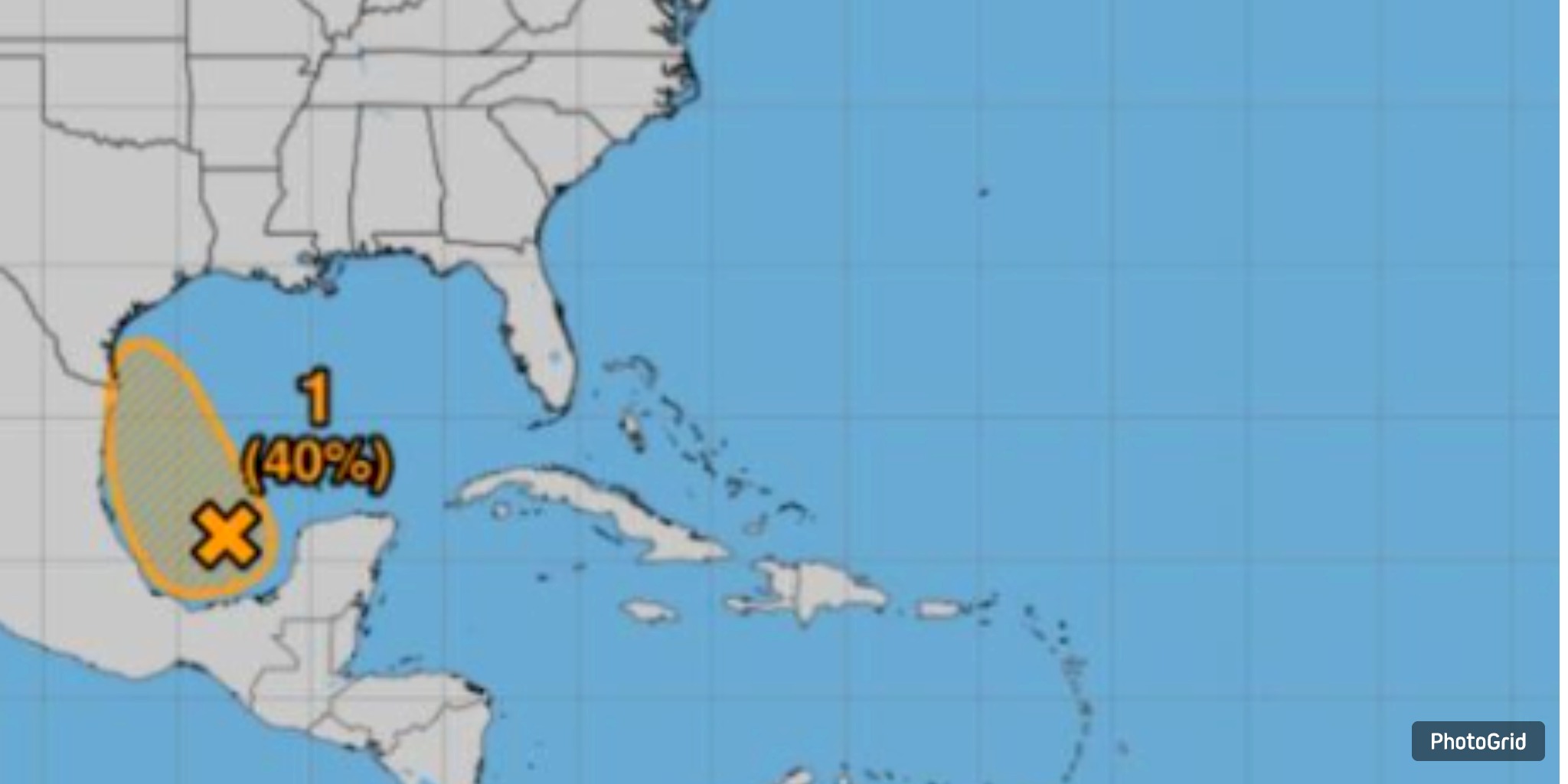
A tropical disturbance brewing in the southwestern Gulf of Mexico is currently assessed to have a 40% likelihood of evolving into a cyclone within the next 48 hours. This system may lead to significant rainfall and hazardous rip currents impacting Houston and Galveston as the weekend approaches, according to the National Weather Service.
On Thursday, forecasters indicated that the low-pressure system is projected to shift west-northwest across the Gulf, with landfall anticipated over northeastern Mexico or southern Texas by Friday or early Saturday.
The Houston-Galveston office of the National Weather Service has issued a warning regarding a significant risk of strong rip currents along the Gulf Coast, accompanied by increased winds and elevated sea levels. Forecasters indicate that the greater Houston area may experience heavy rainfall; however, they do not anticipate widespread severe impacts at this time.
“While there may be some rain and a risk of rip currents, the current conditions do not appear to be conducive to anything more significant,” meteorologist Bradley Brokamp stated Thursday morning. “It’s essential to monitor the forecast continually.” “Circumstances can shift.”
CenterPoint Energy announced that it is actively monitoring the system and stands ready to respond if necessary. “We will persist in our monitoring efforts, assess emerging models and data, and utilize our technological resources to ensure we are ready,” stated Matt Lanza, the utility’s meteorology manager.
A significant weather event is unfolding as Tropical Storm Erin intensifies in the Atlantic, making its way toward the northern Leeward Islands, Virgin Islands, and Puerto Rico. By Friday, Erin is expected to make history as the inaugural hurricane of the 2025 season.
Although Erin is not anticipated to make landfall in the Gulf, its trajectory toward the Caribbean raises concerns for the eastern Caribbean this weekend, where heavy rainfall, powerful rip currents, and winds reaching tropical storm force may be experienced.