
Originally reported by HPM Galveston County.
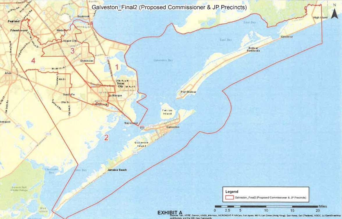
Galveston County's political boundaries shifted Sunday when county commissioners voted to adopt a redrawn precinct map, according to HPM Galveston County. The Galveston County Commissioners Court approved the new boundaries over objections from residents who argued the map would dilute the electoral influence of Black and Hispanic voters — a charge the county has faced in prior redistricting rounds as well.
For Galveston residents, the new map determines which commissioner represents their neighborhood and, in practical terms, who controls decisions on local road funding, emergency management, and coastal infrastructure, issues that hit close to home on Galveston Island, where hurricane preparedness and Seawall maintenance are perennial budget priorities. Voters who feel their precinct assignment has changed should verify their district before the next county election.
Communities across the county are watching closely. League City and Friendswood in the northern part of the county have seen rapid population growth that typically drives redistricting pressure, while Texas City and La Marque, areas with significant minority populations, are at the center of the voting-rights concerns raised by critics. Residents on the Bolivar Peninsula, who depend on county services for ferry access and storm response, also fall under the redrawn lines.
The vote does not happen in a vacuum. Galveston County has faced prior legal scrutiny under the federal Voting Rights Act over whether its precinct boundaries fairly represent communities of color. Redistricting disputes in Texas counties have repeatedly ended in federal court, and advocacy groups have used such rulings to force map revisions. The new map now carries that same litigation risk.
Residents and advocacy organizations are expected to review the approved boundaries in the coming days. If a legal challenge is filed, a federal court could order the county to redraw the map again before the next election cycle, a process that would affect every voter from Tiki Island to the Strand Historic District.
Source: HPM Galveston County, originally reported June 29, 2026; adapted for Galveston readers with original local context.


.png)


