For the first time in a decade, no major hurricane struck the United States during the Atlantic season, yet the year produced unusually intense storms and showcased shifting atmospheric patterns explained by Galveston-based meteorologist Hal Needham.

In a remarkable turn of events, the Atlantic hurricane season has wrapped up for the first time in a decade without a major storm making landfall in the United States. This statistic, however, contrasts sharply with the assessments of meteorologists, who describe the year as unexpectedly active in terms of tropical developments.
The season concluded on November 30, featuring 13 named storms—only one short of the long-term average—although many residents along the Gulf Coast viewed it as relatively calm.
Galveston meteorologist Hal Needham, popularly referred to as “Hurricane Hal,” noted that this perception highlights a common bias: storms tend to be recalled on a local level rather than across the entire basin. “If your area gets hit, even if it is not an active hurricane season, people often recall, ‘Well, 1983 was terrible,’” Needham remarked to Chron, alluding to the year Hurricane Alicia inflicted what was then a staggering $3 billion in damages throughout Greater Houston. Although Alicia made a significant impact, the 1983 season saw the formation of just four named storms.
This year's predictions projected a range of 13 to 19 storms, with expectations of three to five major hurricanes among them. Needham emphasized that the total tally was strikingly near. “There was no real threat to us, so it might seem to some that nothing occurred at all,” he stated. “This year is proving to be quite intriguing…” This year, we experienced 13 named storms, slightly below the typical average of 14.
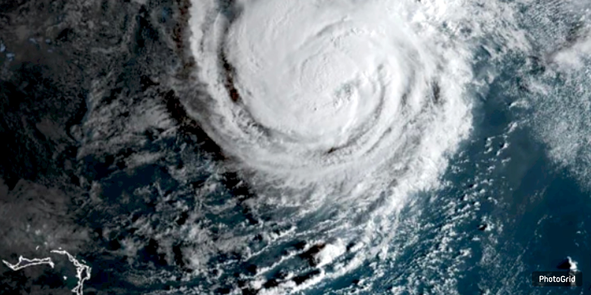
The season may have been sparse in landfalls, but it compensated with remarkable intensity. According to NOAA, there have been three Category 5 hurricanes recorded, marking the highest number since 2005. Hurricane Melissa struck western Jamaica with ferocious sustained winds reaching 185 mph, matching a 1935 record for the lowest central pressure recorded at landfall.
Most of the storms remained offshore. Aside from Tropical Storm Chantal, which made a brief landfall in the Carolinas, no cyclone progressed westward beyond the Bahamas. Needham highlighted the North Atlantic Oscillation (NAO), an index that gauges pressure variations between the Bermuda area and Iceland. The notably positive North Atlantic Oscillation during May and June directed storms toward the east, effectively hindering the high-pressure ridge that usually guides systems into the Gulf of Mexico.
“These hurricanes and tropical storms tend to move directly north; however, there is typically a significant area of high pressure located near Bermuda,” he stated. “The location of that high is entirely dependent on the track.” A negative NAO, he noted, played a role in the devastating Gulf season of 2008, which featured Hurricanes Ike and Gustav.
This year witnessed a significant technological transformation. The National Hurricane Center has integrated Google’s DeepMind AI model into its forecasting toolkit. According to NPR, the model demonstrated remarkable precision in forecasting the path and strength of Hurricane Melissa.
“This perspective is enhancing our understanding of the forecast, and its performance this year has been quite impressive,” Needham stated. “One notable aspect of this year was the presence of numerous significant hurricanes… However, they notably did not make landfall in the U.S.”